")
Sarawak is undergoing one of the most ambitious industrial expansions in Southeast Asia. The oil and gas sector contributes approximately 40% of Sarawak’s GDP, and Petros is investing RM4 billion across strategic hubs in Miri, Bintulu, Samalaju, and Kuching to build out energy infrastructure across the state. Alongside this, Samalaju Industrial Park — the largest industrial park in Borneo — has attracted RM57.2 billion in total approved investments, spanning aluminium smelting, ferroalloys, petrochemicals, and energy.
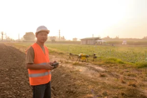
This scale of industrial activity creates an urgent, growing demand for one thing: fast, accurate, and safe inspection of critical infrastructure. That is exactly what professional drone inspection services in Sarawak deliver.
Aerial Tech & Defense System provides CAAM-certified drone inspection services across Sarawak — from oil and gas pipelines in Miri to industrial facilities in Bintulu, coastal infrastructure in Kuching, and energy assets throughout the SCORE corridor. This guide explains why drone inspection is now essential for Sarawak’s industries, what services are available, and how to choose the right provider.
Why Sarawak’s Industries Need Drone Inspection Services Now
Sarawak’s industrial landscape presents inspection challenges that are unlike any other state in Malaysia. Vast distances between sites, dense rainforest terrain, offshore platforms, remote river systems, and the sheer scale of industrial parks like Samalaju make traditional inspection methods — scaffolding, rope access, manual walkthroughs — slow, expensive, and often dangerous.
Drone inspection services solve all of these problems simultaneously:
Safety first. Sending workers to inspect the top of an LNG storage tank in Bintulu, a high-voltage transmission line crossing the Rajang River, or the underside of a bridge along the Pan Borneo Highway puts lives at risk. Drones perform the same inspection remotely, with zero worker exposure to height, heat, or confined-space hazards.
Speed at scale. A drone can inspect a pipeline corridor or plantation boundary in hours that would take a ground team days. For Sarawak’s vast industrial sites — where assets are spread across hundreds or thousands of hectares — this speed difference is operationally critical.
Data quality. Modern drone inspection systems carry thermal cameras, LiDAR sensors, high-resolution RGB cameras, and multispectral payloads. These tools detect structural defects, heat anomalies, corrosion, water ingress, and vegetation encroachment with a level of detail that manual inspection simply cannot match.
Regulatory compliance. Industrial operators across Sarawak face increasing pressure from regulators and insurers to demonstrate proactive asset maintenance. Drone inspection reports — with GPS-tagged images, thermal data overlays, and timestamped flight logs — provide the documented evidence that compliance requires.
Drone Inspection Services in Sarawak: Key Industries We Serve
Oil & Gas Pipeline and Offshore Inspection in Miri and Bintulu
Miri is the birthplace of Malaysia’s oil and gas industry, which started in 1910, and today stands as one of East Malaysia’s most dynamic marine and offshore centres. The city and its surrounding offshore zones host an extensive network of pipelines, processing plants, offshore platforms, and storage facilities — all of which require regular inspection to detect leaks, corrosion, structural fatigue, and safety hazards.
Drone inspection services in Sarawak’s oil and gas sector offer a direct alternative to costly and disruptive conventional inspection methods:
- Pipeline corridor surveillance along onshore routes — identifying encroachment, erosion, and third-party damage
- Offshore platform and flare stack inspection using thermal and visual drones — without personnel at height
- Storage tank roof and shell inspection for corrosion, weld defects, and seal integrity
- Jetty and marine terminal inspection in Bintulu and Miri ports
With Petros resuming onshore gas drilling in Miri after 30 years, and a new 500-megawatt combined cycle power plant underway, the inspection demand in Miri’s energy sector is set to grow significantly through 2027 and beyond.
Industrial Facility Inspection at Samalaju Industrial Park and Bintulu
Spanning 8,000 hectares, Samalaju Industrial Park is the largest industrial park in Borneo and a crucial growth node under the Sarawak Corridor of Renewable Energy (SCORE). It is home to energy-intensive industries including aluminium smelting, ferroalloy production, polysilicon manufacturing, and industrial gas operations — all of which operate large-scale, high-value assets that require regular structural and thermal inspection.
Drone inspection services at Samalaju and the broader Bintulu industrial zone include:
- Roof and structural inspection of smelting halls, warehouses, and processing facilities
- Thermal imaging of electrical substations, transformer yards, and HV cable runs
- Chimney stack and industrial flue inspection — identifying cracks, erosion, and thermal leaks
- Facility perimeter and boundary mapping for security and compliance documentation
- Progress monitoring of the 65-kilometre Bintulu-Samalaju gas pipeline and other active infrastructure construction
Infrastructure and Construction Inspection Across Sarawak
Sarawak’s Pan Borneo Highway, Baleh hydroelectric project, port expansions in Kuching and Tanjung Manis, and the ongoing development of the Kuching Low-Carbon Hub represent billions of ringgit in active construction — all of which benefits from regular aerial inspection and progress monitoring.
Drone inspection services for infrastructure projects in Sarawak include:
- Bridge and highway structure inspection — detecting surface cracking, spalling, and deformation
- Dam and hydroelectric facility monitoring — including the Bakun, Murum, and Baleh projects
- Construction progress photogrammetry — generating orthomosaic maps and 3D models for project reporting
- Earthwork volume calculations and cut-and-fill analysis using drone-derived terrain models
- Coastal and port infrastructure inspection in Kuching, Sibu, Bintulu, and Miri
Utilities, Power Lines, and Renewable Energy Inspection
Sarawak’s electricity grid spans one of the most geographically challenging territories in Malaysia — crossing rivers, rainforest, and remote highlands to connect industrial hubs with power generation assets. Manual inspection of transmission lines in these conditions is expensive and hazardous.
Our drone inspection services for utilities in Sarawak include:
- Transmission line inspection along rural and forested corridors — identifying conductor damage, insulator faults, and tower corrosion
- Substation thermal inspection — detecting hotspots on switchgear, busbars, and transformers before failure occurs
- Solar farm panel inspection using thermal imaging — identifying underperforming panels, bypass diode failures, and soiling patterns
- Hydroelectric dam face and spillway inspection — Bakun, Murum, and the upcoming 1,285MW Baleh project
Agriculture, Plantation, and Land Management in Sarawak
Sarawak’s vast rural landscape — home to oil palm plantations, pepper farms, paddy fields, and managed forest reserves — presents inspection challenges that ground teams cannot efficiently address. Drone inspection and mapping services provide plantation managers and land agencies with actionable aerial data at a fraction of traditional survey costs.
Services include:
- Multispectral crop health mapping — identifying stress, disease, and nutrient deficiency across large plantation areas
- Flood and erosion monitoring along riverbanks and low-lying agricultural zones
- Land boundary verification and mapping for native customary rights (NCR) land and development projects
- Forest canopy monitoring and illegal logging detection in protected areas
Emergency Response and Environmental Monitoring
Sarawak’s geography makes it vulnerable to floods, landslides, and forest fires — particularly in the interior and river basin areas. Drone inspection services provide emergency response teams and government agencies with the aerial situational awareness needed to coordinate rapid and effective responses.
- Flood mapping and inundation extent assessment along the Rajang, Baram, and Sarawak river systems
- Post-disaster structural inspection of affected buildings, bridges, and roads
- Forest fire hotspot detection using thermal imaging — supporting early intervention
- Environmental compliance monitoring for industrial sites near sensitive ecological zones
What Professional Drone Inspection in Sarawak Delivers
Choosing a professional, CAAM-certified drone inspection provider means your organisation receives more than just aerial footage. At Aerial Tech & Defense System, every inspection project in Sarawak includes:
Pre-flight planning and CAAM permit management. All commercial drone operations in Malaysia require CAAM authorisation. We handle the full permit process — including airspace checks, risk assessments, and method statements — so your project stays legal and on schedule.
Multi-payload drone operations. Depending on your inspection type, we deploy drones equipped with 4K visual cameras, radiometric thermal sensors, LiDAR scanners, or multispectral payloads — selecting the right tool for each application.
Processed, actionable deliverables. Raw drone footage is only the start. We process and analyse all data to deliver orthomosaic maps, 3D point clouds, thermal anomaly reports, annotated inspection images, and written findings — in formats compatible with your GIS, CAD, or asset management systems.
CAAM-certified pilots. All flights are conducted by licensed Remote Pilot Licence (RPL) holders with industrial inspection experience. This is non-negotiable for commercial operations in Sarawak’s regulated airspace.
Full documentation. Every inspection generates flight logs, GPS records, and timestamped image metadata — providing the audit trail that regulatory compliance and insurance documentation requires.
Why Choose Aerial Tech & Defense System for Drone Inspection in Sarawak?
Aerial Tech & Defense System is not a general drone photography company. We are a specialist UAV operations and training organisation with deep roots in Borneo — headquartered in Kota Kinabalu, Sabah, with active operations across Sarawak, Peninsular Malaysia, and beyond.
What sets us apart for industrial drone inspection in Sarawak:
- Born in Borneo. We understand the terrain, the regulations, the industries, and the operational challenges unique to East Malaysia better than any Peninsular-based provider
- CAAM-certified across all categories. Our pilots and operations comply fully with Malaysian civil aviation regulations for commercial drone services
- Industrial-grade equipment. We operate professional-grade UAV systems with thermal, LiDAR, and multispectral payloads — not consumer drones
- End-to-end service. From permit applications to final report delivery, we manage the entire inspection workflow
- Training capability. As a CAAM-recognised training academy, we can also upskill your in-house team to conduct routine drone inspections independently
Frequently Asked Questions — Drone Inspection Services in Sarawak
What types of assets can be inspected by drone in Sarawak?
Virtually any industrial or infrastructure asset. Our drone inspection services in Sarawak cover oil and gas pipelines, offshore platforms, storage tanks, industrial buildings, transmission lines, bridges, dams, solar farms, plantations, and coastal infrastructure. If it can be seen from the air, it can be inspected by drone — faster, safer, and more cost-effectively than manual methods.
Do drone inspection companies need a permit to operate in Sarawak?
Yes. All commercial drone operations in Malaysia, including Sarawak, require authorisation from CAAM (Civil Aviation Authority of Malaysia). Additional approvals may be needed for operations near airports in Kuching, Miri, Bintulu, and Sibu, or over restricted industrial zones. Aerial Tech & Defense System manages all permit applications on your behalf as a standard part of every inspection project.
Can drones inspect oil and gas assets in Sarawak’s offshore areas?
Yes, with the appropriate permits and vessel or platform access coordination. We conduct offshore drone inspections for platform structures, flare stacks, and marine loading arms. All offshore operations comply with PETRONAS and CAAM safety requirements, and are planned in coordination with your site safety team.
Does Aerial Tech also offer drone pilot training in Sarawak?
Yes. In addition to full-service drone inspection operations, our CAAM-recognised academy offers Remote Pilot Licence (RPL) training for individuals and corporate teams. If your organisation wants to build in-house drone inspection capability for routine monitoring tasks, we can train your personnel to the required certification standard. Visit our Academy & Trainings page for current course schedules.
Get Professional Drone Inspection Services in Sarawak
Sarawak’s industrial growth is accelerating — and so is the demand for fast, accurate, and safe inspection of the assets that power it. Whether you operate in oil and gas, heavy industry, infrastructure, utilities, or agriculture, Aerial Tech & Defense System has the equipment, the certification, and the on-the-ground experience to deliver drone inspection results you can act on.
Contact our team today to discuss your inspection requirements: Contact Us